€250 - €500
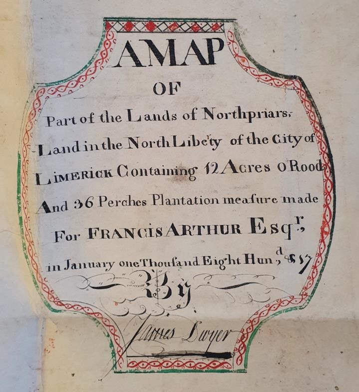
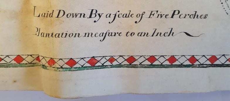
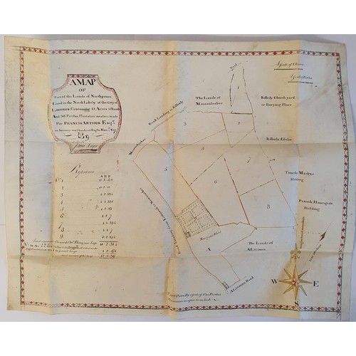
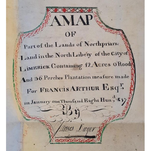
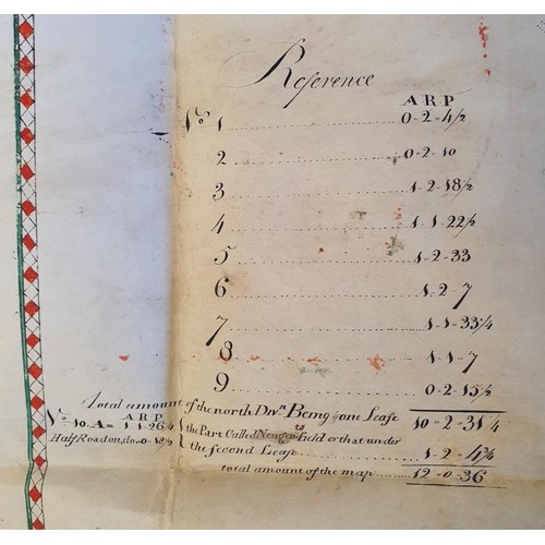
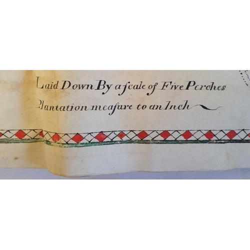
Superb eighteenth century manuscript Map of Limerick . A Map of Part of the Lands of Northpriars, land in the North Liberty of the City of Limerick containing 12 acres, 0 Roods and 36 Perches Plantation Measure made from Francis Arthur in January one thousand eight hundred and seven by James Dwyer. Approximately 60 by 30 centimeters. Coloured. Large format fold. Vellum. Superbly illustrated of the Thomondgate area of Limerick city.
Fees apply to the hammer price:
Room and Absentee Bids:
25% inc VAT*
Online and Autobids:
28.69% inc VAT*